 Photo From pixabay
Originally Posted On: https://hapondo.qa/blog/doha-metro-map/
The Doha Metro is one of the major transportation projects in Qatar serving Doha and major districts around the country. Since the Doha Metro is a new transportation system in the country, we have provided you with the Doha Metro map outlining the Red Line, Green Line and Gold Line. You can use the map to guide you with using the metro system.
The Doha Metro Map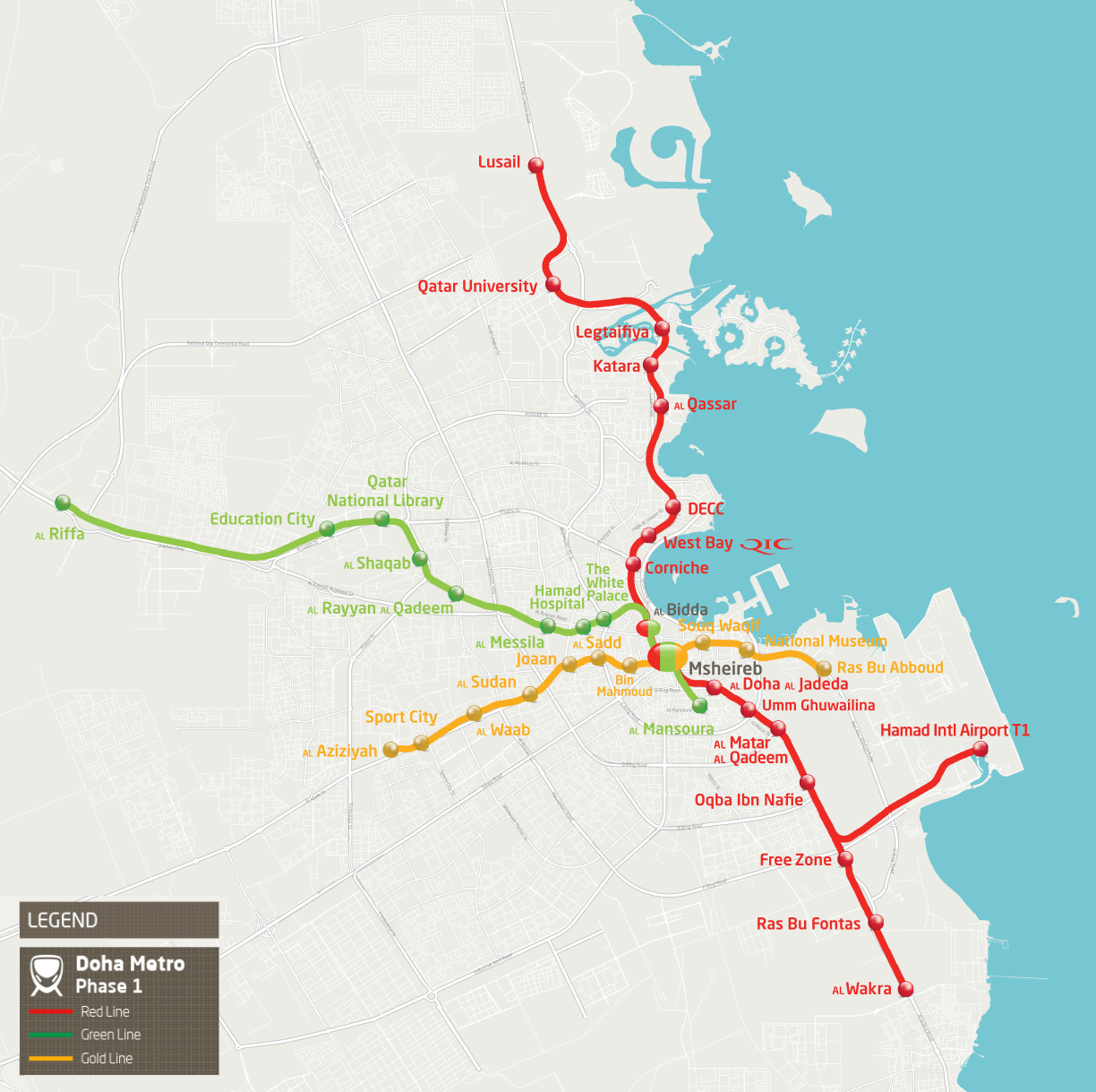 Doha Metro Map. Map Source: qr.com.qa
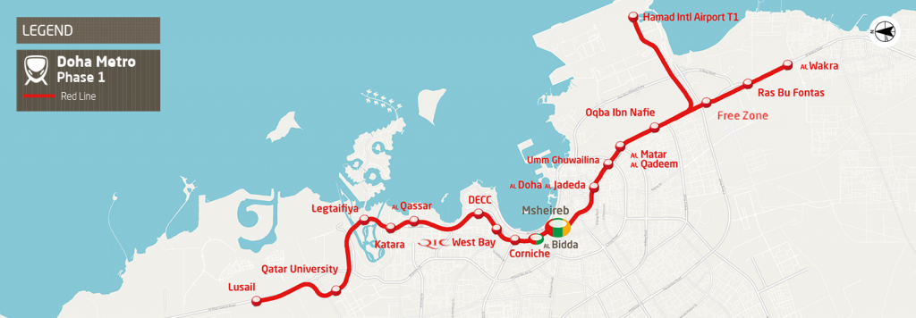 Red Line Map – Map Source: qr.com.qa
The red metro line runs along 40KM from Al Wakra to Lusail City. The line also connections Hamad International Airport at Terminal 1 to Doha City. The current stations on this line include:
• Al Bidda ( Interchange station)
• Corniche
• QIC West Bay
• DECC
• Al Qassar
• Katara
• Lusail
• Hamad Intl. Airport T1
• Qatar University
• Al Wakra
• Ras Bu Fontas
• Free Zone
• Oqba Ibn Nafie
• Old Aiport
• Umm Ghawalina
• Al Doha Al Jadeda
• Msheireb ( Interchange station)
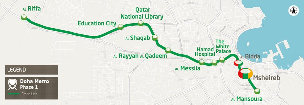 Green Line Map – Map Source: qr.com.qa
The green metro line runs from Al Mansoura to Al Riffa. There are eleven stations along the green line and these include:
• Al Mansoura
• Msheireb ( Interchange station)
• Al Bidda ( Interchange station)
• The White Palace
• Hamad Hospital
• Al Messila
• Al Rayyan Al Qadeem
• Al Shaqab
• Qatar National Library
• Education city
• Al Riffa
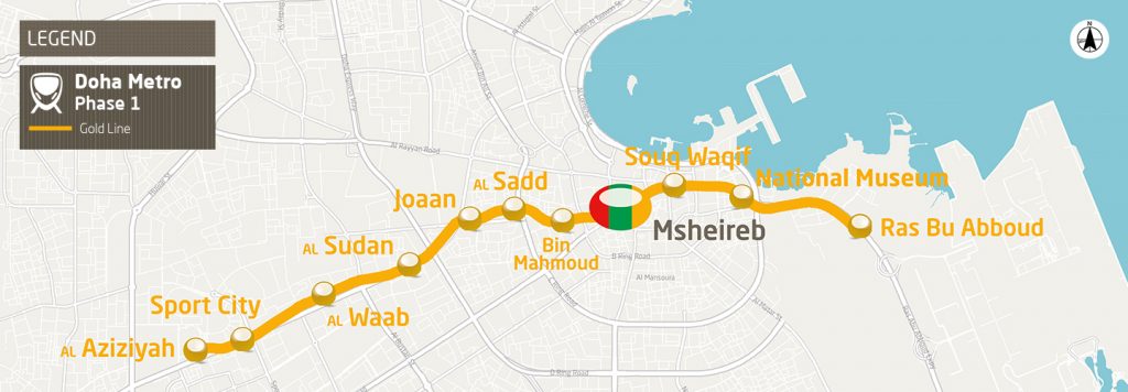 Gold Line Map – Map Source: qr.com.qa
Finally, the gold line metro line extends from Ras Bu Aboud to Al Aziziyah area with eleven stations running through this metro line which includes:
• Ras Bu Abboud
• National Museum
• Souq Waqif
• Msheireb ( Interchange station)
• Bin Mahmoud
• Al Sadd
• Joaan
• Al Sudan
• Al Waab
• Sport City
• Al Aziziyah
