
With DroneDeploy’s Fieldscanner, pilots can create maps as they fly
April 18, 2017 at 10:41 AM EDT
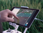

Flying drones to inspect a farm, construction site, or any other venue from overhead can generate a huge amount of data. It takes time, though, for drone users to upload and turn this high-resolution data into maps, graphs or business intelligence they can act upon. Today, a data management platform for drones called DroneDeploy, is launching a tool called Fieldscanner that makes it possible… Read More
